Camino Del Norte Through San Sebastian
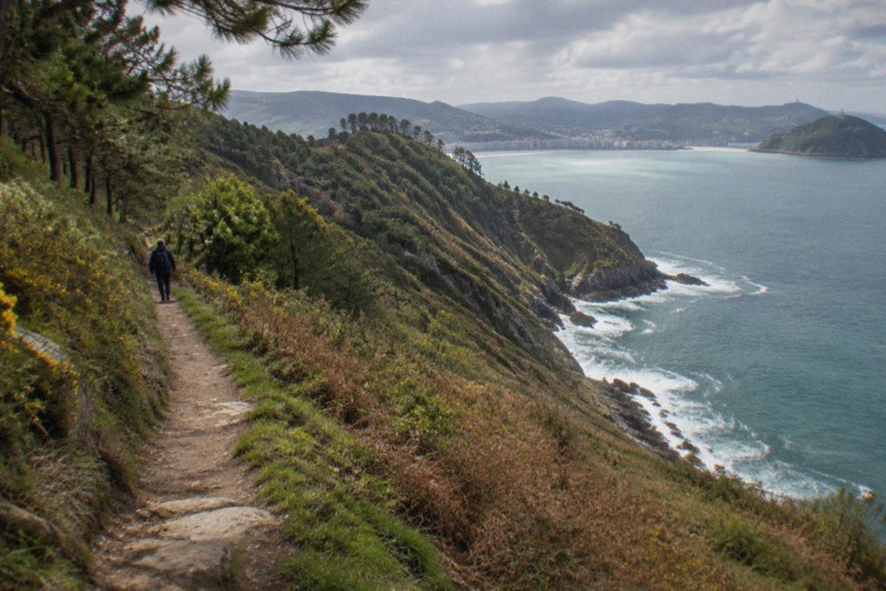
The Camino del Norte, the northern coastal route of the Camino de Santiago, passes straight through San Sebastián, and the city stage is one of the most walked sections of the whole pilgrimage.
Short answer
The Camino del Norte is a moderate to demanding long-distance walk, and the San Sebastián stages are among its gentler coastal sections, with paved paths into and out of the city and the hills beginning west of the River Oria.
The Camino del Norte, the northern coastal route of the Camino de Santiago, crosses San Sebastián, the Basque city on La Concha bay whose official name is Donostia / San Sebastián. Pilgrims arrive over the hills from Pasaia in the east, drop down to the seafront, walk the whole curve of La Concha, and leave the next morning along the Ondarreta end toward Orio. The city is a natural rest point: it has the densest accommodation and food offer of any stop on the Gipuzkoa coast, and the walking on either side of it is the reason many people choose the northern route over the Camino Francés in the first place.
The route's World Heritage standing comes from exactly this stretch of coast. UNESCO's list entry "Routes of Santiago de Compostela: Camino Francés and Routes of Northern Spain" includes the coastal route that crosses the city, though San Sebastián itself holds no World Heritage inscription of its own. For orientation before the walking details, the guide to where San Sebastian sits on the map covers the city's position between the mountains and the Bay of Biscay, and this whole site, San Sebastian Spain Guide, exists to cover the city stage by stage.
What Is The Camino Del Norte Through San Sebastian?
The Camino del Norte is the northern coastal route of the Camino de Santiago, running west along the Bay of Biscay from Irun toward Galicia, and it crosses San Sebastián in two stages: Pasaia to Donostia on the way in, and Donostia to Orio on the way out. The tourism board lists the Gipuzkoa coastal stages as Irun-Hondarribia-Lezo-Pasaia, then Pasaia-Donostia, then Donostia-Orio, then Orio-Zarautz, Zarautz-Getaria-Zumaia, and Zumaia-Itziar-Deba. The city sits at the end of the second stage, which means most pilgrims arrive in the afternoon, sleep in the city, and set out the following morning on the third.
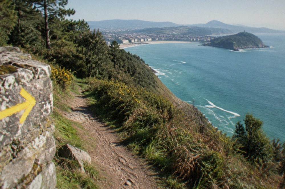
Waymarking through the city follows the same yellow arrows and scallop-shell symbols used along the entire route. The arrival from Pasaia comes down from the Ulia headland, the same ridge described in the Monte Ulia guide, and enters the Gros district near the Kursaal before crossing the Urumea river toward the Parte Vieja. From there the route runs the full promenade of La Concha, past Ondarreta, and climbs gently toward the Igeldo ridge and the Peine del Viento, Chillida's sculptures at the western tip, before descending toward Orio.
This table shows the tourism board's coastal stages as they are listed for Gipuzkoa, with the city's own position marked.
| Stage | Route | Notes for walkers |
|---|---|---|
| 1 | Irun-Hondarribia-Lezo-Pasaia | Border start at Irun, harbour town at the end |
| 2 | Pasaia-Donostia | The arrival stage into San Sebastián, over the Ulia headland |
| 3 | Donostia-Orio | The departure stage, along La Concha and over the Igeldo ridge |
| 4 | Orio-Zarautz | Coastal farmland and the Zarautz beach front |
| 5 | Zarautz-Getaria-Zumaia | Getaria's fishing port and the start of the flysch coast |
| 6 | Zumaia-Itziar-Deba | The last Gipuzkoa stage, entering the Geopark coastline |
The stages beyond the city continue along the flysch coast at Zumaia, whose rock formations the route follows after the Getaria stage, and the whole coast west of the city is covered by the day trips from San Sebastian guide.
How Difficult Is The Camino Del Norte?
The Camino del Norte is a moderate to demanding walk overall, with repeated coastal hills, but the two stages through San Sebastián are among its gentler: the Pasaia-Donostia stage climbs over the Ulia headland on a mix of footpath and track, and the Donostia-Orio stage is mostly promenade and quiet road until the Igeldo climb. Difficulty on this route is cumulative rather than dramatic. No single Gipuzkoa stage involves mountaineering, but the northern route's total profile rises and falls far more than the Camino Francés, because the path keeps dropping to coves and climbing back to headlands.
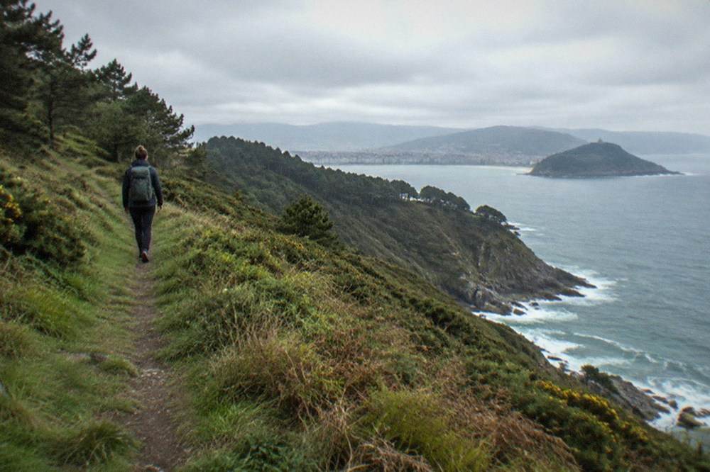
Three factors decide how hard any given pilgrim finds it. The first is surface: the city stages include long paved stretches, while the stages west of Orio use more farm track and footpath. The second is weather: this is a wet Atlantic coast, and AEMET's Igeldo station records 1,507 mm of rain a year over 141 rain days, so boots get tested by mud and wet stone even in summer. The third is pack weight, because the rolling profile punishes heavy loads more than flat routes do.
The city's own walking offer is a good way to test your legs on the terrain before committing to a full stage. A guided hike on the Camino over Mount Ulia to the lighthouse covers the same ridge the arrival stage uses, and the coastal winery trail walk below pairs the same terrain with txakoli tastings.
For walkers who want the coastal Camino landscape with a food thread running through it, the coastal winery trail walk pairs the path with txakoli tastings, and you can Check availability on the operator's live listing.
How Long Does It Take To Walk El Camino Del Norte?
Walking the full Camino del Norte from Irun to Santiago de Compostela typically takes five to six weeks of continuous walking, while the Gipuzkoa coastal section through San Sebastián is a four to six day walk depending on how you split the stages. The tourism board lists six stages across the province, from the French border at Irun to Deba, and the city sits on the night between stage two and stage three. Many people walk only this coastal stretch as a standalone trip and return by train, which the Euskotren Topo line makes straightforward from the stations along the coast.
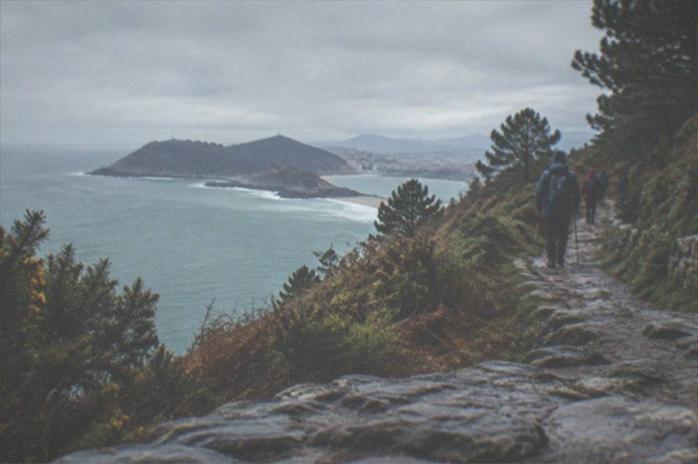
The city itself rewards a rest day. Pilgrims commonly spend an extra night in San Sebastián to eat pintxos in the Parte Vieja, and the pintxo guide plus the best pintxo bars page cover where to do that. A rest day can be filled without walking another kilometre, from the beaches to the museums.
This table breaks the province's stages into a realistic walking plan with a rest day in the city.
| Day | Walking | Overnight base |
|---|---|---|
| 1 | Irun to Pasaia by way of Hondarribia and Lezo | Pasaia |
| 2 | Pasaia to Donostia over the Ulia headland | San Sebastián |
| 3 | Rest day in the city, or La Concha and Ondarreta on foot | San Sebastián |
| 4 | Donostia to Orio over the Igeldo ridge | Orio |
| 5 | Orio to Zarautz, then on to Getaria | Getaria |
| 6 | Getaria to Zumaia, then Zumaia to Deba | Deba |
If five or six weeks is not realistic, the coastal section works as its own trip. One question walkers often pair with this is how far the Camino del Norte runs from San Sebastián to Bilbao, which has its own answer page covering that continuation east to west.
What Is The Best Time Of Year To Do The Camino Del Norte?
The best months to walk the Camino del Norte through San Sebastián are May, June and September, when AEMET's Igeldo normals show mean temperatures of 14.4, 16.9 and 18.0 degrees Celsius and monthly rainfall of 120, 90 and 111 mm, a meaningful drop from the 141 to 169 mm of the winter months. July is the driest month on the station's record at 86 mm, but it is also the busiest, and the city's hotel occupancy peaks in August. September combines the year's second-driest profile with sea temperatures that still suit a swim at the end of a stage.
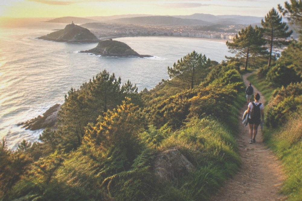
The honest caveat is that no month on this coast is dry. Even July averages 9.8 days with a millimetre or more of rain, and August, at 117 mm, is wetter than June, July or September. Walkers who come expecting Mediterranean summer weather will be disappointed; the San Sebastian weather guide and the best time to visit page cover the climate in full, and the monthly rain figures matter more to a pilgrim than any average temperature.
| Month | Mean temp C | Rain mm | Rain days | Sun hours | Verdict for walking |
|---|---|---|---|---|---|
| March | 10.3 | 113 | 12.4 | 144 | Cool, wet, quiet paths |
| April | 11.3 | 138 | 13.4 | 157 | Wettest spring month on this record |
| May | 14.4 | 120 | 12.2 | 181 | Good balance of weather and quiet |
| June | 16.9 | 90 | 10.6 | 189 | Driest of the shoulder months |
| July | 18.9 | 86 | 9.8 | 196 | Driest, but busiest on the coast |
| August | 19.5 | 117 | 10.5 | 190 | Peak crowds, and wetter than July |
| September | 18.0 | 111 | 10.1 | 179 | The strong favourite for this route |
| October | 15.5 | 159 | 11.8 | 140 | Wet returns, shortening days |
Figures are AEMET climate normals for the Donostia / San Sebastián, Igeldo station, period 1981 to 2010. The station sits at 250 m on Monte Igeldo, so the seafront path runs slightly warmer than these values suggest.
Which Part Of The Camino Del Norte Is The Most Beautiful?
The stretch between San Sebastián and Getaria is the stretch most walkers name as the most beautiful of the whole Gipuzkoa coast, because it combines the La Concha promenade, the Igeldo ridge descent, Zarautz's long beach front and the fishing port of Getaria in three consecutive stages. East of the city, the Ulia headland between Pasaia and Donostia runs high above coves with the whole bay opening up on the descent. West of the city, the path crosses farmland above the sea before dropping into Zarautz, whose beach the council measures at 800 m.
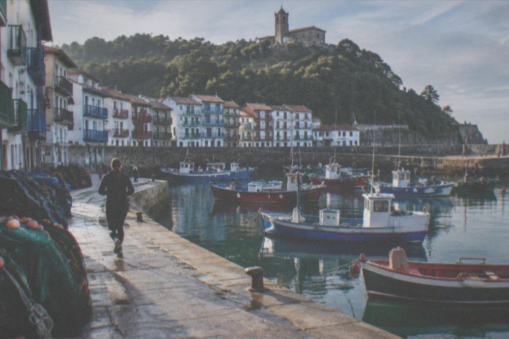
Beauty on this route is not only scenery. The stage ends are working towns: Pasaia's harbour, Getaria's port beneath the Balenciaga museum, Zumaia at the mouth of the flysch cliffs. The Getaria guide covers the best-known of the city's walking neighbours, and the coastal towns can each be reached by bus or train if you would rather walk one direction only.
The table below pairs each stage with what walkers actually stop to look at.
| Stage | What the stage is known for |
|---|---|
| Pasaia-Donostia | The Ulia ridge path, the lighthouse, and the first full view of La Concha |
| Donostia-Orio | The La Concha and Ondarreta promenade, the Peine del Viento, the Igeldo ridge |
| Orio-Zarautz | Farm tracks above the sea and the long Zarautz beach arrival |
| Zarautz-Getaria | Coastal ridge walking above Getaria's harbour and the Balenciaga museum |
| Getaria-Zumaia | The start of the flysch coast and the Geopark boundary |
For a taste of the coastal landscape without a multi-day commitment, a guided coastal walk with txakoli tastings at a winery along the trail covers the same terrain in a single outing, with a train ticket back to the city included.
Where Does The Camino Enter And Leave San Sebastian?
The Camino del Norte enters San Sebastián from Pasaia over the Monte Ulia ridge, coming down into Gros near the Kursaal, crosses the Urumea, and leaves the next morning along the La Concha promenade, past Ondarreta and up over the Igeldo ridge toward Orio. Both of the city's boundary crossings are on signed, waymarked paths, and both have an alternative on quieter roads where the ridge path is impractical. The arrival side is the more dramatic of the two: the Ulia access hours run 08:00 to 21:00 from 1 May to 30 September and 08:00 to 19:30 from 1 October to 30 April, which matters for anyone planning a late arrival in the darker months.
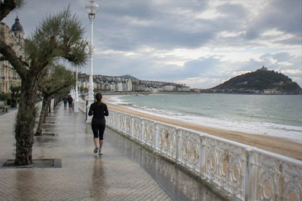
Inside the city, the route doubles as a sightseeing line. It passes the Basilica of Santa Maria at the edge of the Parte Vieja, runs the full La Concha beach front, and exits past the Peine del Viento sculptures. Pilgrims arriving in the late afternoon can eat in the Old Town before checking in, and the what to eat in San Sebastian guide lists the dishes worth ordering the night before a walking day.
The key practical facts for the two city stages sit in this table.
| Stage | Entry or exit point | Terrain | Waymarking |
|---|---|---|---|
| Pasaia-Donostia | Ulia ridge down into Gros | Footpath and track, one sustained climb | Yellow arrows and scallop shells |
| Donostia-Orio | La Concha promenade to the Igeldo ridge | Promenade, then track and quiet road | Yellow arrows and scallop shells |
Can You Walk The Camino Del Norte In Sections From San Sebastian?
Yes, the Camino del Norte works well as a section walk based in San Sebastián, because the Euskotren Topo line and the coastal Lurraldebus network let you walk one direction along a stage and ride back, or walk short segments as day walks. The Topo runs from the city's Amara station along the coast toward Hendaia, with services every 30 minutes on the busiest day in the current timetable, so a morning walk over Ulia from Pasaia back to the city needs no return logistics at all. Walking west, the bus network serves Orio, Zarautz, Getaria and Zumaia.
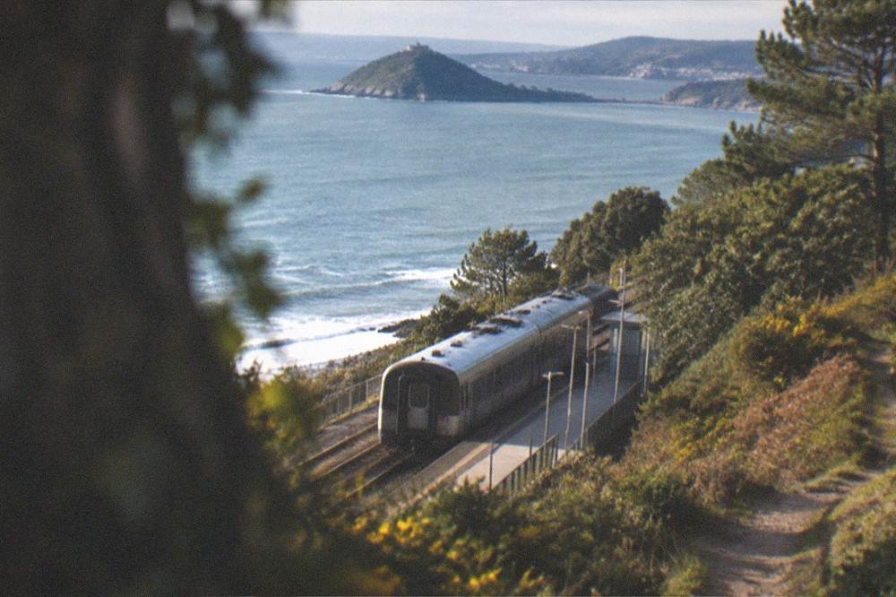
Section walkers should still carry the pilgrim's credential if they intend to collect stamps toward the Compostela, because the requirement is distance walked, not continuity. A section plan built around the city might look like this.
| Day-walk option | Direction | Return method |
|---|---|---|
| Ulia ridge | Pasaia to Donostia | Topo train from Pasaia to the start, walk home |
| Igeldo ridge | Donostia toward Orio, turn back | City bus from the Ondarreta end |
| Zarautz beach | Orio to Zarautz | Lurraldebus back along the coast |
| Flysch coast | Zumaia segment | Train or bus back to the city |
The getting around San Sebastian guide covers the fare system, and a half-day coastal walk fits comfortably into even a short visit.
What Should You Pack For The Camino Del Norte Through San Sebastian?
Pack for wet Atlantic walking rather than a dry Spanish summer: broken-in waterproof boots or trail shoes, a proper rain shell, a change layer, and a pack light enough to carry over repeated coastal hills, because this route's difficulty is in its ups and downs, not in any technical ground. The rain record is the packing driver. With 141 rain days a year at the Igeldo station and no month averaging under 86 mm, wet-weather gear is not seasonal here, it is baseline. Poles help on the ridge descents, particularly the wet stone on the Ulia side.
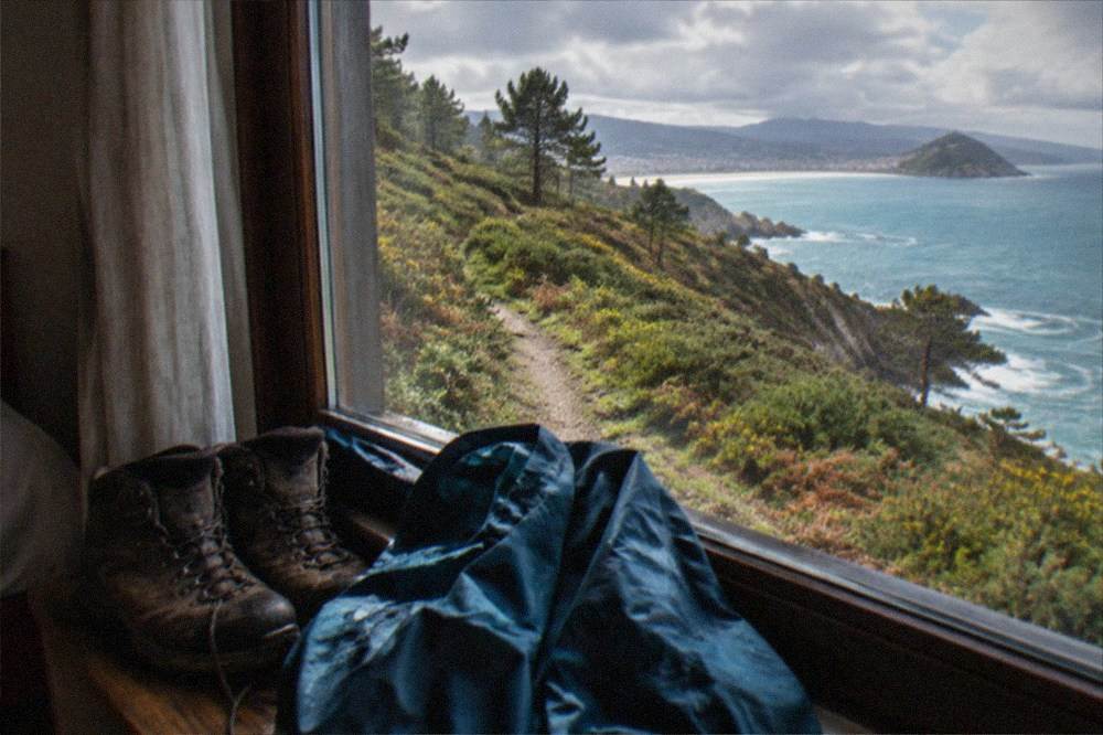
City stages need nothing beyond ordinary day-walking kit, and anything forgotten can be bought in the centre. The table below is a packing list matched to the conditions the climate normals actually describe.
| Item | Why it earns its place |
|---|---|
| Waterproof rain shell | Rain falls on roughly 10 days even in the driest month |
| Broken-in trail shoes or boots | Wet stone and farm track on both ridge stages |
| Poles | The Ulia and Igeldo descents, especially in rain |
| Quick-dry layers | Humid Atlantic air, mean 13.5 C across the year |
| Credential and stamps | Required if you want the Compostela certificate |
| Swimwear | La Concha and Zarautz are on or beside the route |
After a week of coastal hills, a rest day on the water is a common pivot: the bay boat with a Santa Clara island stop and the sunset catamaran sailing both run from the harbour the route passes on its way into Gros, and the small-group electric bike tour is a way to cover the flat seafront miles without a step.
Common Questions About The Camino Del Norte
How long does it take to walk el Camino del Norte?
The full route from Irun to Santiago de Compostela typically takes five to six weeks of continuous walking. The Gipuzkoa coastal section through San Sebastián, six stages from the French border to Deba, is a four to six day walk, and many people walk only that stretch as a standalone trip.
What is the best time of year to do the Camino del Norte?
May, June and September are the strongest months, with 90 to 120 mm of rain each against 141 to 169 mm in the winter months, and mean temperatures from 14.4 to 18.0 degrees Celsius. July is the driest month but also the busiest on the coast, and no month here is genuinely dry.
Which part of the Camino del Norte is the most beautiful?
Most walkers name the stretch between San Sebastián and Getaria: the La Concha promenade, the Igeldo ridge descent, Zarautz's long beach and Getaria's fishing port across three consecutive stages. East of the city, the Ulia ridge between Pasaia and Donostia runs high above the coves and is its equal for views.
Does the Camino del Norte go through San Sebastian?
Yes. The route arrives over the Ulia headland from Pasaia, crosses the city past the Kursaal, the Parte Vieja and the full La Concha promenade, and leaves toward Orio over the Igeldo ridge. The city is the overnight stop between the second and third of the tourism board's six Gipuzkoa stages.
Do you need to book accommodation ahead on the Camino del Norte?
In July and August, yes, because the city's hotel occupancy peaks in August and the coastal towns are small. From October to April the pressure drops sharply, though some coastal lodgings close for winter, so check before setting out in the low season.
Is the Camino del Norte harder than the Camino Frances?
Generally yes. The northern route climbs and descends repeatedly as it follows the coastline, while the Camino Francés crosses longer stretches of plain. No Gipuzkoa stage involves technical ground, but the cumulative profile is more demanding, and the wet climate adds to the load.
The Camino del Norte through San Sebastián is a rare thing on a long-distance trail: a route whose hardest-looking section contains its most comfortable overnight stop, with the Atlantic on one side the whole way and a city full of pintxos at the end of the day's walking. Walk it in June or September, pack for rain regardless, and the coastal stages through the city will be the part of the pilgrimage you talk about afterwards.