Monte Ulia And The Coastal Walk To Pasaia
Monte Ulia is the green headland that closes off the east end of San Sebastián, and the coastal Camino de Santiago crosses it on the way to Pasaia. This page covers the trailhead, the route, the seasons and the guided options.
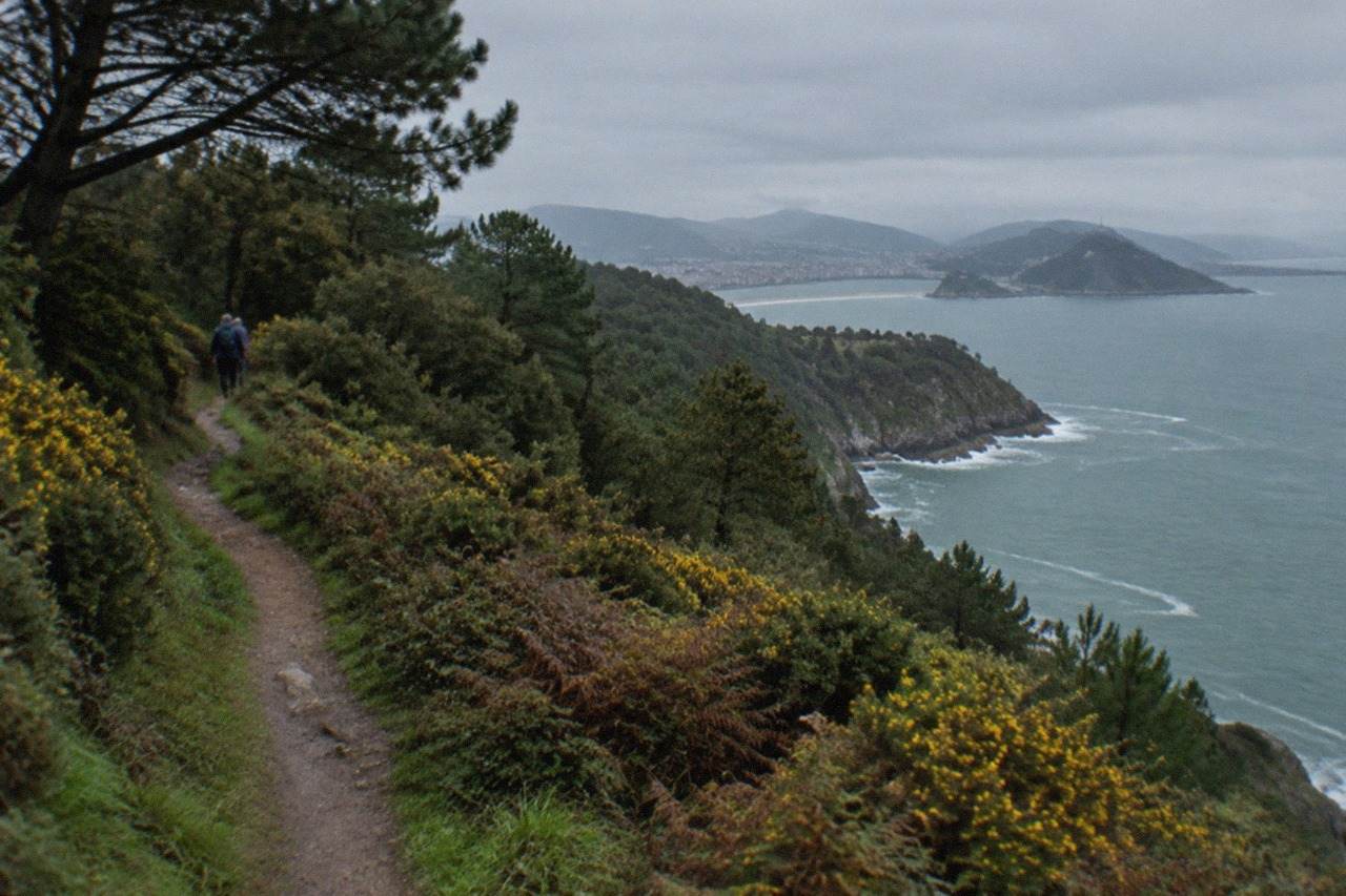
Short answer
Monte Ulia is the wooded headland east of Zurriola beach in San Sebastián, Basque Country, Spain. The coastal Camino de Santiago crosses it between the city and Pasaia, and a guided hike runs from the Kursaal to the Ulia lighthouse. Walk it between June and September for the longest daylight, but expect rain in any month.
Monte Ulia is the wooded headland that rises east of San Sebastián, in the Basque Country of Spain, and separates the city from the fishing port of Pasaia. The city's Basque name is Donostia, and its official municipal name is Donostia / San Sebastián, but this page follows the site's convention and calls it San Sebastián in prose. Ulia is the least visited of the city's three hills: Urgull sits in the middle of town, Igueldo anchors the west end of La Concha bay, and Ulia faces east over Zurriola beach and the open coast toward France. What makes Ulia different is that it is not a viewpoint with a funicular or a museum on top. It is a walking hill, and the walk that crosses it is one of the oldest waymarked routes in Europe: the coastal Camino de Santiago, whose second and third stages the tourism board lists as Pasaia-Donostia and Donostia-Orio, with the Donostia ends of both crossing this headland.
What Is Monte Ulia In San Sebastian?
Monte Ulia is the eastern headland of San Sebastián, a wooded ridge that runs out between Zurriola beach and the port of Pasaia, and the section of the coastal Camino de Santiago that the tourism board lists between the city and its neighbours. Unlike Monte Urgull, which keeps published access hours, or Monte Igueldo, which charges for its grounds, Ulia is known primarily as walking country: a green corridor of paths, cliffs and woodland that pilgrims have crossed for centuries on the Northern route toward Santiago de Compostela.
That last point matters more than is generally realised. The city's own World Heritage link runs through this landscape: the UNESCO inscription "Routes of Santiago de Compostela: Camino Francés and Routes of Northern Spain", list number 669, covers the Northern routes, and the coastal route that crosses the city is part of them. The city itself is not a World Heritage Site, and no monument in it is inscribed on its own, but the Camino is, and Ulia is one of the places where the route leaves the streets and climbs onto open ground. A walker on the ridge is on a path with a documented history rather than a municipal hiking trail invented last decade.
The hill also frames the eastern edge of the city's beach life. Zurriola, the surf beach in the Gros district, sits directly below the start of the ridge, and the council's own beach page describes it as sandy, fairly open, with a strong swell, remodelled in 1994. From the sand at Zurriola the ground climbs quickly, and the bay view opens behind you: La Concha curving away to the west, Santa Clara island in the middle, and the two western hills, Urgull and Igueldo, holding either end. For the full picture of the city's hills, the pages on Monte Urgull and Monte Igueldo cover the other two, and the root things to do in San Sebastian page places all three in context.
Ulia's character is quieter than either of its rivals. There is no amusement park on top, as Igueldo has, and no castle museum, as Urgull has. What there is, at the far end, is a lighthouse above the cliffs, woodland on the slopes, and a long stretch of coast where the Basque shoreline turns from city beach into rock. The day trip guide to Pasaia picks up the story at the other end of the ridge, where the path drops toward the bay that shelters the San Juan whaleship.
How Do You Get To The Monte Ulia Trailhead?
The practical starting points for Monte Ulia are the Gros district beside Zurriola beach and the Kursaal congress centre on the seafront, both reachable on foot or by city bus from anywhere in central San Sebastián. The dBus occasional ticket is 1.95 EUR paid to the driver, the night ticket is 2.65 EUR, and cash payment does not allow free transfers, so a MUGI card, at 0.78 EUR for an urban trip, is the cheaper option for anyone making more than a couple of journeys.
The geography makes the start easy to find. The Kursaal, Rafael Moneo's twin glass cubes on the mouth of the Urumea, was officially inaugurated on 23 August 1999 after Moneo's proposal was chosen in 1990 from six invited architects, and it stands where the river meets the sea between the centre and Gros. From there the seafront promenade runs east along Zurriola, and the ridge begins above the sand. A walker who wants the simplest possible start follows the beach to its far end and takes the paths that climb from there.
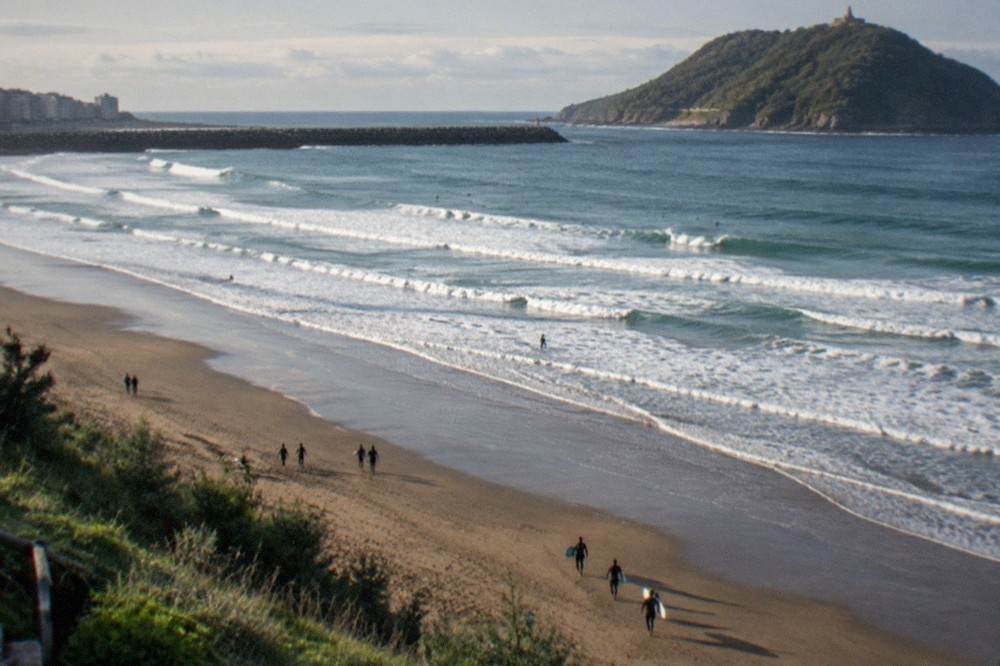
Public transport on this side of the city is cheap and simple. The fares below are the ones the operators publish for the journeys that touch this walk, and they are worth knowing before you set out, especially if you plan to return from Pasaia by train rather than retracing your steps.
| Ticket | Price | Notes from the operator |
|---|---|---|
| dBus occasional, cash to driver | 1.95 EUR | No free transfers with cash |
| dBus night ticket | 2.65 EUR | Special night fare |
| MUGI anonymous card, urban trip | 0.78 EUR | Covers dBus, Lurraldebus and Euskotren |
| Topo occasional, Amara to Hendaia | 2.90 EUR | The 1-jump MUGI fare on the same line |
The MUGI line matters for the return leg. "Urbano 1", the cheapest zone on the system, is defined on the tariff page as "Donostia y motora Pasaia", which means the motor boat that crosses Pasaia's bay is inside the urban fare, and the Topo line runs east along the coast from the Amara-Donostia station toward the border at Hendaia, a journey the timetable data puts at 37 to 38 minutes with a train roughly every 30 minutes on the busiest service day. A one-way walk over Ulia with a train or boat back is the shape most independent walkers settle on. The train option is the one the guided coastal walk uses too: the listing for that tour includes the return train ticket in the price.
One thing not to plan on: walking the ridge in reverse and riding down, in the style some visitors try on Igueldo. Monte Igueldo's own home page states plainly that downhill-only funicular tickets are not on sale, and Ulia has no mechanical descent at all, so the return is on foot, by train or by boat, whatever direction you start from.
What Does The Walk From San Sebastian To Pasaia Involve?
The route over Monte Ulia is the coastal Camino de Santiago between the city and Pasaia, a cliff-and-woodland section that the tourism board lists as stage 2, Pasaia-Donostia, walked in the pilgrim direction, with stage 3, Donostia-Orio, continuing west from the city. The ridge carries the path through woodland and along clifftops to the Ulia lighthouse above the port, and the descent ends at the water in Pasaia, where the motor boat crossing is inside the urban MUGI fare.
No stage distance is published by the tourism board, so plan by daylight and by the guided tours' published durations rather than by a kilometre figure. That sentence is deliberate. Plenty of pages quote a distance for this walk, but the tourism board's own Camino page gives stages without distances, and this site does not print a number it cannot source. What the pack does give is the shape of the route and the transport at each end, which is what a walker actually needs.
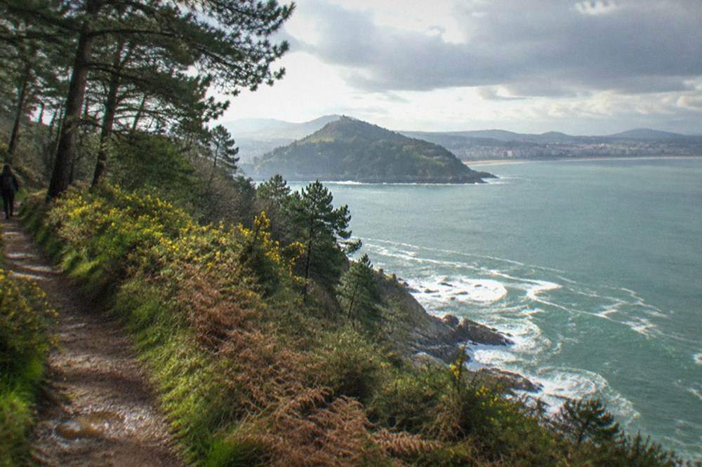
The full coastal route as the tourism board lists it, for context, runs through six stages in Gipuzkoa. Ulia sits at the junction of the second and third, which is why so many pilgrims pass through the city without ever walking its western hills.
| Stage | Route as listed by the tourism board |
|---|---|
| 1 | Irun, Hondarribia, Lezo, Pasaia |
| 2 | Pasaia, Donostia |
| 3 | Donostia, Orio |
| 4 | Orio, Zarautz |
| 5 | Zarautz, Getaria, Zumaia |
| 6 | Zumaia, Itziar, Deba |
Walked from the city eastward, the route climbs from Gros onto the ridge, follows the crest through woodland, and keeps to the clifftops as the coast bends north toward the entrance to Pasaia's bay. The lighthouse at the far end is the landmark most walkers aim for, and the guided Camino hike on the roster runs from the Kursaal to that lighthouse as its turnaround. Beyond it the path drops toward the port, one of the great small-boat harbours of the Basque coast, where the Albaola shipyard is building the San Juan whaleship, a replica of a whaler, and the Albaola page covers the yard itself.
The port is split by its bay: Pasajes de San Juan on one side, San Pedro on the other, and the motor boat that links them is the "motora Pasaia" named in the MUGI urban fare definition, so the crossing costs the same as a city bus trip. From the far side, the Topo line brings you back along the coast. The half-day guided excursion to Hondarribia and the Pasajes villages, for anyone who wants the port without the walk, is another option on the roster.
If the self-guided version appeals but the logistics feel like work, the guided coastal walk bundles the pieces: it starts from Amara station, includes a market tasting, three txakoli tastings at a winery, and the train ticket back.
Is Monte Ulia Part Of The Camino De Santiago?
Yes. Monte Ulia carries the coastal Camino de Santiago, the Northern route, between Pasaia and the city on stage 2 and between the city and Orio on stage 3, as the tourism board's own stage list records. The route's UNESCO inscription, "Routes of Santiago de Compostela: Camino Francés and Routes of Northern Spain", list number 669, includes the Northern routes, so the path across the ridge belongs to a World Heritage-listed ensemble.
The city of San Sebastián itself holds no World Heritage status of its own, which is the distinction that matters here. The inscription covers the routes, not the towns they pass through, and Ulia is one of the places where that distinction becomes visible: the path is inscribed, the hill is not. Other pages covering the same trip are gathered on San Sebastian Spain Guide.
This is the fact that gives the hill its weight. Pilgrims walking the Camino del Norte from Irun toward Galicia cross Ulia on their second day, and the city treats them as a normal part of summer foot traffic. The route is waymarked with the familiar scallop and arrow signage of the Camino, and in July and August the city's hotel data shows why the paths feel busy: August is the peak month for hotel overnight stays in the city, at 245,769 in 2025, a little over twice January's figure, and July and August together account for 22 percent of the year's stays.
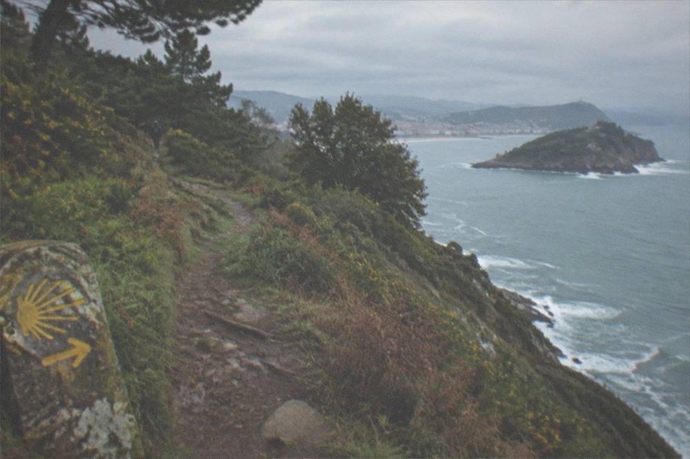
For a visitor who is not walking to Santiago, the Camino connection still shapes the experience. The path is maintained, waymarked and walked year-round, which is more than can be said for most coastal footpaths, and the direction of travel is unambiguous: the ridge runs east-west and the sea is always on one side. Losing the way on Ulia takes real effort.
The Camino also explains the lighthouse. The structure at the ridge end guides traffic into Pasaia's bay entrance, a narrow channel between the headland and the far shore, and the guided hike on the roster makes it the destination. The answer page on what the Monte Igueldo funicular is covers the western hill's mechanical ascent for contrast, if you are weighing which hill to give your time.
What Will You See From Monte Ulia?
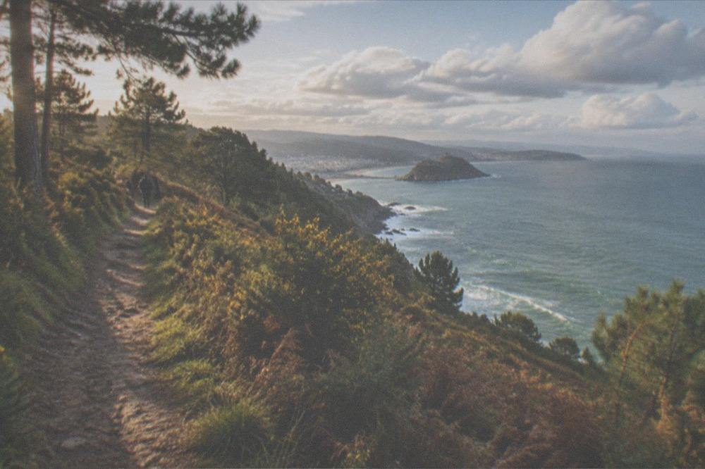
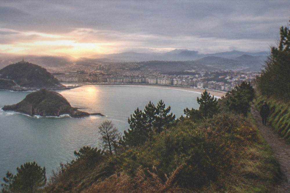
The view from the Monte Ulia ridge takes in the whole of San Sebastián from the east: Zurriola beach immediately below, La Concha bay curving west with Santa Clara island in the middle, Monte Urgull and Monte Igueldo at either end of the bay, and, looking outward, the open Bay of Biscay and the coastline running toward Pasaia and the French border. On clear days the perspective is the reverse of the postcard: instead of seeing the city from its hills, you see all three hills at once.
The city view is the first reward, and it comes early. Within the first stretch of climbing above Gros, the whole bay opens behind: the curve of La Concha beach, 1,350 metres long on the council's figures, with Ondarreta continuing west of the headland and Santa Clara island sitting in the middle of the bay. The council's beach page notes that the tide often limits La Concha's usable area, and from Ulia's height you can see exactly what that means, the wet sand and the dry sand reading as two different colours.
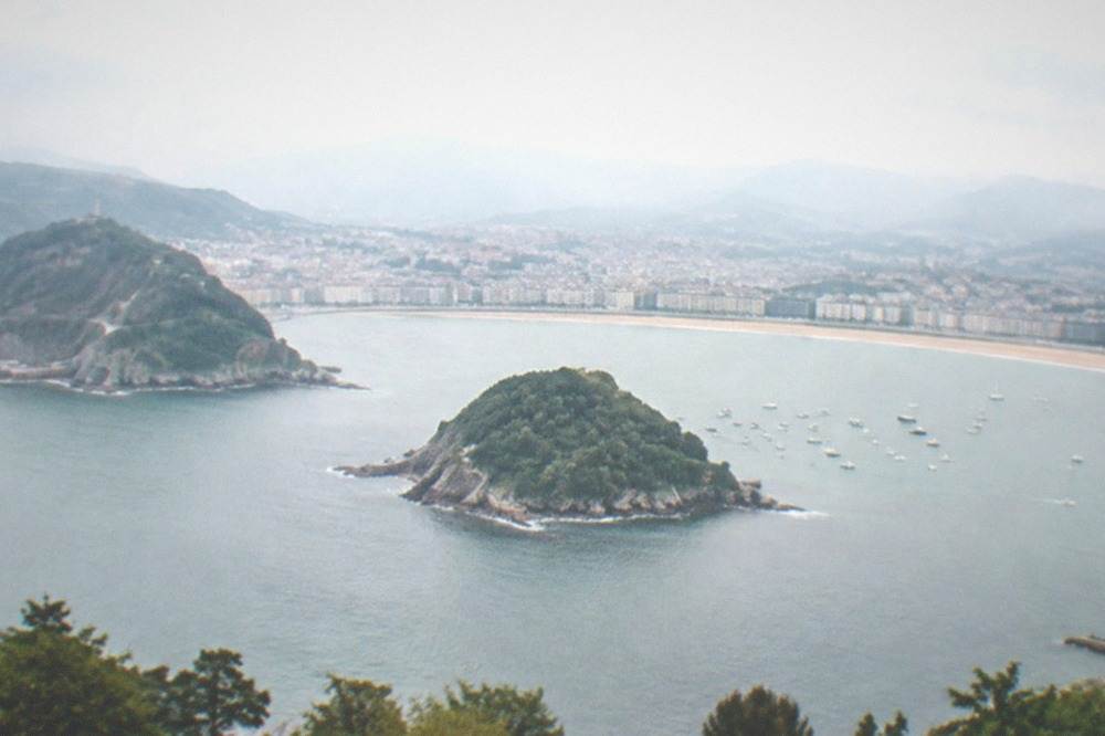
The seaward view is the one that changes as you walk. Out over the Bay of Biscay the water is open to the north, and the coast bends away toward the cliffs that lead to Pasaia. On the descent, the port appears below, its houses pressed to the waterline around a bay that opens to the sea through the narrow channel under the lighthouse. The Peine del Viento, Eduardo Chillida's three steel sculptures of more than nine tonnes each on the rocks at the far end of the bay, is on the opposite, western side of the city, and the Peine del Viento page covers it; Ulia's own sculpture story is the landscape itself.
To compare the three hills in one place, the table below sets out what each one offers, using the figures each venue or authority publishes.
| Hill | What is on top | Access as published |
|---|---|---|
| Monte Urgull | Castillo de la Mota, Casa de la Historia | 08:00 to 21:00 from 1 May to 30 September, 08:00 to 19:30 from 1 October to 30 April |
| Monte Igueldo | Amusement park, viewpoint | Funicular return 5.50 EUR adult, 2.50 EUR child, grounds entry included |
| Monte Ulia | Woodland, clifftops, lighthouse | Camino de Santiago stages 2 and 3 cross the ridge |
When Is The Best Time To Walk Monte Ulia?
The best walking window on Monte Ulia is June to September, when the city's mean daily temperature runs from 16.9 to 19.5 degrees C, but no month on this coast is reliably dry: AEMET's normals for its Igeldo station record 1,507 mm of rain a year over 141 rain days, and even July, the driest month, averages 86 mm. August is wetter than June, July or September, at 117 mm, so pack a shell layer in every month, including high summer.
The "dry summer" instinct fails here, and the numbers below show why. The climate table pulls the months that matter most for planning a ridge walk: the shoulder months when the paths are quiet, the summer peak, and the two wettest months to be realistic about. Both figures in each comparison come from the same AEMET series, 1981 to 2010, recorded at the Igeldo station 250 metres up on Monte Igueldo, so the seafront runs slightly warmer than these values.
| Month | Mean C | Rain mm | Rain days 1 mm+ | Sun hours |
|---|---|---|---|---|
| April | 11.3 | 138 | 13.4 | 157 |
| June | 16.9 | 90 | 10.6 | 189 |
| July | 18.9 | 86 | 9.8 | 196 |
| August | 19.5 | 117 | 10.5 | 190 |
| September | 18.0 | 111 | 10.1 | 179 |
| October | 15.5 | 159 | 11.8 | 140 |
| November | 11.3 | 169 | 13.0 | 102 |
Two seasonal notes sharpen the picture. First, the city's lifeguard and beach season, 1 June to 30 September on all three beaches, is also the season when the island boats run their high-season timetable, so a summer walk can end with a swim at Zurriola, where the council flags a strong swell, or with a boat trip from the harbour. Second, October and November are the wet pair, 159 mm and then 169 mm, and November is the wettest month of the whole year, so an autumn walker should plan the ridge for the morning and keep the afternoon flexible. The rain does not close the hill, but it changes what the cliffs look like and how much of the view survives.
Winter walking is perfectly possible and much quieter, at 8.5 degrees C mean in January and 98 sun hours, but daylight is short and the woodland sections hold mud. Whatever the month, the hill is a better morning than an afternoon: the view west is lit from mid-morning onward, and the sea haze that softens the far coast tends to build later in the day.
Should You Take A Guided Tour On Monte Ulia?
A guided tour on Monte Ulia suits anyone who wants the ridge, the lighthouse or the Pasaia coast without organising trailheads, return trains and timing alone, and the roster carries two walks that cover it: a guided Camino de Santiago hike over the mountain to the Ulia lighthouse from the Kursaal, and a coastal winery trail walk from Amara station with three txakoli tastings and the return train ticket included. Both are small-group operations, and both take decisions that otherwise fall on you.
The Camino hike is the purer walking option. It starts at the Kursaal, follows the pilgrim route over the mountain, and turns around at the lighthouse, which makes it the closest thing on the roster to the classic Ulia outing.
The coastal winery walk is the fuller day out. It trades the pure ridge walk for a route that ends in txakoli country, with a market tasting at the start, three tastings at a winery, and the train back to the city already paid for inside the price. Txakoli is the local white wine of this coast, the wine the Basque Country is actually known for, and tasting it at the end of a coastal walk rather than in a city bar is the point of the format.
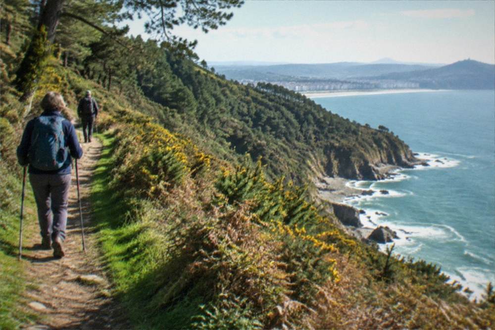
For walkers who prefer to go alone, the independent version costs almost nothing beyond bus and train fares, and the yellow waymarks do the route-finding. The honest trade-off is interpretation: a guide explains the Camino, the coast and the cider and wine culture in a couple of hours, and a map does not. The middle option is the small-group electric bike tour, which covers the city's bike-lane network and the beaches on the eastern side rather than the ridge itself, a good pairing for a day when the weather looks doubtful.
A final pairing thought: Ulia walks end hungry, and the city's answer to hunger is pintxos, the small Basque bar bites served across the Old Town. The pintxos guide explains what they are, and a pintxo tour in the evening after a morning on the ridge is a combination the city does extremely well.
Common Questions About Monte Ulia
How long does the Monte Ulia walk take?
No stage distance or walking time for the ridge is published by the tourism board, so this site prints none. The guided Camino hike over the mountain to the Ulia lighthouse carries its own duration on the operator's listing, and the coastal winery trail walk does the same; both are the reliable way to budget your time.
Can you walk from San Sebastian to Pasaia?
Yes. The coastal Camino de Santiago stage 2, listed by the tourism board as Pasaia-Donostia, crosses Monte Ulia in either direction, and the city end of the route starts from the Gros side beside Zurriola beach. The return is by Topo train along the coast or by boat and bus.
Is Monte Ulia part of the Camino de Santiago?
It is. The Northern route's Gipuzkoa stages include Pasaia-Donostia and Donostia-Orio, and both cross the ridge. The route belongs to the UNESCO-listed "Routes of Santiago de Compostela: Camino Francés and Routes of Northern Spain", though the city itself is not a World Heritage Site.
Do you need a ticket for Monte Ulia?
No. Ulia is open hill country crossed by a public waymarked route, with no entry charge. This is the contrast with Monte Igueldo, where entry to the grounds is 3.00 EUR per person and the funicular return is 5.50 EUR adult, 2.50 EUR child.
What is the best month to walk Monte Ulia?
June and July combine the warmest early-summer weather with the lowest rainfall, 90 mm and 86 mm respectively on AEMET's Igeldo normals, and September stays warm at 18.0 degrees C mean. August is the busiest month in the city's hotels and is also wetter than June or July, at 117 mm, so book rooms early and keep a rain layer handy.
Can you see La Concha from Monte Ulia?
Yes, and the whole bay at once: La Concha beach, 1,350 metres on the council's figures, Ondarreta beyond it, Santa Clara island in the middle of the bay, and Monte Urgull and Monte Igueldo at either end. It is the only one of the city's hills from which you can see the other two clearly.
Monte Ulia is the walk that completes the city: the hill with no ticket, no queue and no machinery, just a World Heritage-listed pilgrim route running through woodland to a lighthouse above one of the prettiest small ports on the Basque coast, and a train to bring you back.