San Sebastian Map: Beaches, Old Town And Neighbourhoods
San Sebastián, in the Basque Country of Spain, folds into one compact bay, and once you can picture the map, everything else about the city falls into place.
Short answer
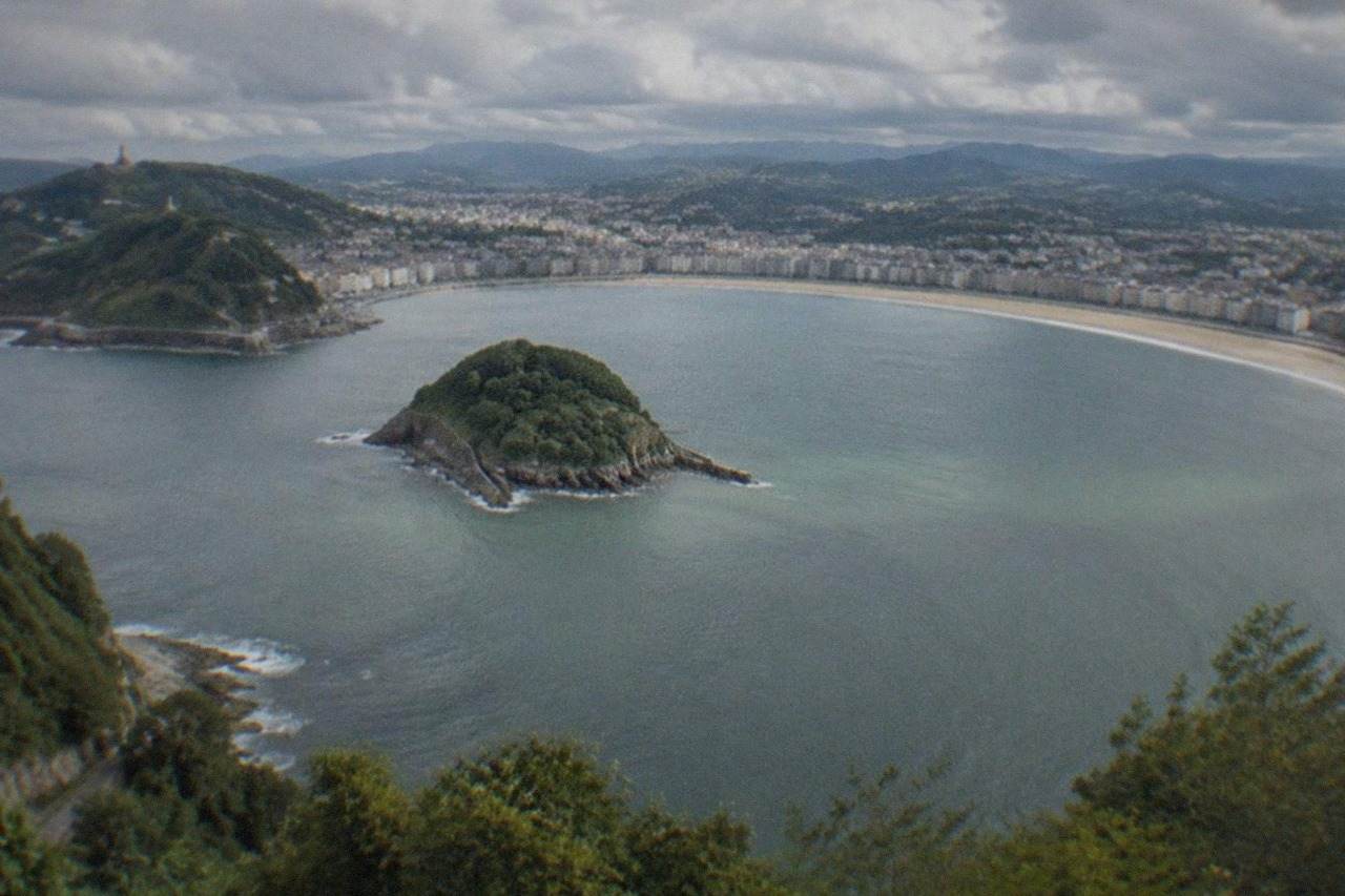
San Sebastián sits on a single crescent bay, La Concha, with the Old Town and Centre between the two hills of Urgull and Igueldo, Zurriola beach and the Gros district on the ocean side, and Santa Clara island in the middle of the water.
San Sebastián, the Basque city on La Concha bay whose official name is Donostia / San Sebastián, is one of the most compact major cities in Spain, and that compactness is the single most useful thing a map can tell you. The whole city fits inside a single crescent of coast. Two hills, Urgull and Igueldo, close the bay at either end, a small island sits in the middle of the water, and the ocean-facing beach of Zurriola opens the city's eastern side to the Atlantic. Donostia, the Basque name, appears on local signage alongside the Spanish one, and either form is official.
This page walks the map from the water inward: first the bay and its three beaches, then the Old Town, then the hills, the island, the neighbourhoods behind the promenade, and finally the edges of the map where the day trips begin. If you want the broader orientation first, where San Sebastian sits in the region covers the distances to Bilbao, Biarritz and the airports.
How Is San Sebastian Laid Out On The Map?
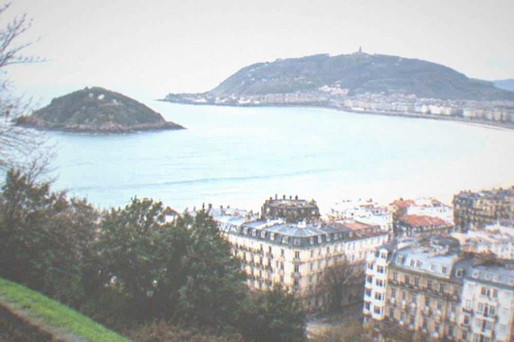
San Sebastián is built around one crescent bay, La Concha, with Monte Urgull closing the eastern end, Monte Igueldo closing the western end, and Santa Clara island sitting in the middle of the water. The Old Town and the Centre fill the flat ground between the two hills, Zurriola beach faces the open ocean on the far side of Urgull, and the River Urumea divides the Centre from the Gros district before reaching the sea.
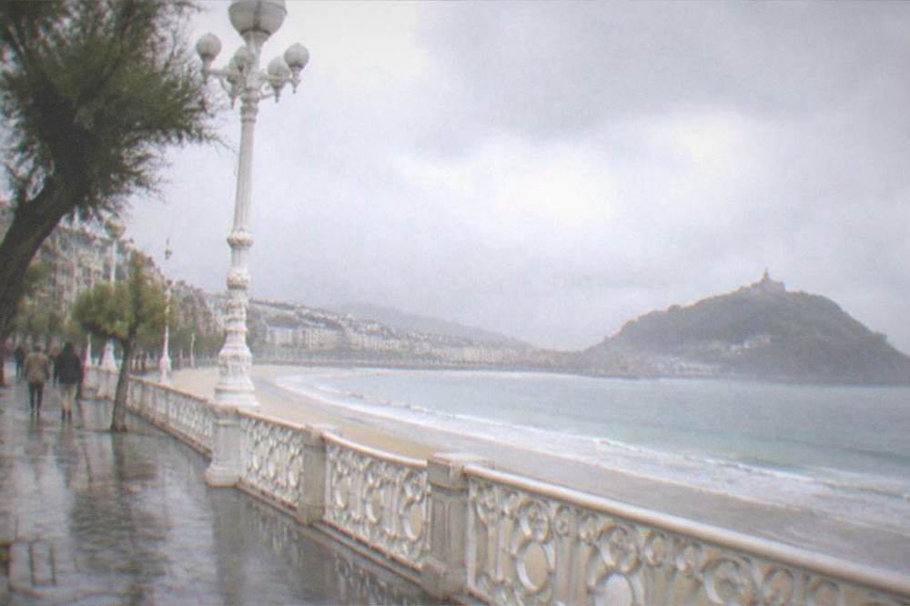
Almost everything a visitor wants sits within a walkable strip between the two hills. The promenade that runs the length of La Concha connects the Old Town end to Ondarreta and the Peine del Viento at the foot of Igueldo, and the whole arc takes in the city's most photographed scenery. Behind that front line, the neighbourhoods stack up in a shallow bowl: the Centre and its grid of 19th-century streets, then Amara and Egia further back along the river and the rail lines. The map is small enough that a wrong turn is rarely a loss, and the two hills work as permanent landmarks: if you can see Urgull's silhouette you are looking east, and Igueldo's tower marks west.
The river matters more than its size suggests. The Urumea arrives from the south, cuts between the Centre and Gros, and empties into the sea right beside the Kursaal, so the three bridges that cross it, including the Maria Cristina bridge with its ornamental lamps, are the everyday crossing points between the pintxo half of the map and the surf half. The tourism board counts three airports within a little over 100 km of the city, two of them international, which is why so many visitors arrive with no car at all and never miss one.
The table below names each district and what the map position means in practice.
| District | Position on the map | What defines it |
|---|---|---|
| Parte Vieja (Old Town) | Between Monte Urgull and the River Urumea | The medieval street plan, pintxo bars and Plaza de la Constitución |
| Centro | Between the Urumea and La Concha promenade | The 19th-century grid, shops and the Buen Pastor cathedral |
| Gros | East of the Urumea, behind Zurriola | Surf beach, younger bar scene, the Kursaal on its edge |
| Antiguo | West end, behind Ondarreta | Residential, the university area, Miramar Palace nearby |
| Amara | South of the Centre, inland | The main rail and bus terminus, sports stadium |
| Egia | South-east, across the river | Tabakalera, the Cristina Enea park, rail lines |
For a deeper look at each of these, the neighbourhoods guide covers them one by one, and the Old Town guide does the same for the medieval core.
Where Are The Three Beaches On A San Sebastian Map?
La Concha runs 1,350 metres along the bay between the Old Town and Ondarreta, Ondarreta continues 600 metres at the west end below Monte Igueldo, and Zurriola lies on the ocean side of Monte Urgull, 800 metres long and facing the open Atlantic with a strong swell. The council's own beach pages give these figures, and a fourth, small beach sits on Santa Clara island.
The three beaches are not interchangeable, and the map explains why. La Concha is sandy and shallow, and the council notes that the tide often limits the usable sand, so the wide postcard beach at midday can be half its width at low water. Ondarreta is the quieter continuation at the foot of Igueldo, and the walk to the Peine del Viento, Eduardo Chillida's three steel sculptures anchored to the rocks, starts at its west end. Zurriola is the surf beach, remodelled in 1994 and described by the council as fairly open with strong swell, which is why board riders gather there rather than in the bay. Lifeguards work all three beaches only from 1 June to 30 September, 10:00 to 20:00 from mid-June to mid-September, with shorter hours either side, and parasol hire runs on a similar season rule.
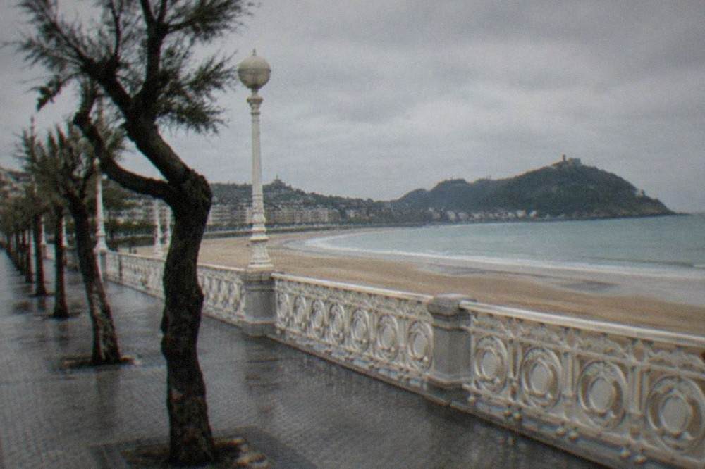
Reading the three together, the map tells you which beach to head for before you even see the water. Swimmers and families default to La Concha, where the water stays shallow well out from the shore. Anyone who wants waves walks around Urgull or crosses the river to Gros, because Zurriola takes the Atlantic swell the bay is sheltered from. And anyone who wants the quiet end, with the sculpture at the finish, walks west along the promenade to Ondarreta.
| Beach | Length | Mean width | Character, from the council page |
|---|---|---|---|
| La Concha | 1,350 m | 40 m | Sandy and shallow, tide often limits usable sand |
| Ondarreta | 600 m | 100 m | Sandy, heavy use, leads to the Peine del Viento |
| Zurriola | 800 m | 110 m | Sandy, fairly open, strong swell, remodelled 1994 |
The full beach-by-beach breakdown, including what each stretch is best for, is in the San Sebastian beaches guide, and the question of which one suits you is worth settling before you arrive, because the wrong beach for a swimmer is a fine beach for a surfer.
Where Is The Old Town On A San Sebastian Map?
The Old Town, the Parte Vieja, occupies the tight rectangle between Monte Urgull and the River Urumea, bounded by the harbour on one side and the Alameda boulevard on the other. Its street plan is medieval, its three parallel streets are lined with pintxo bars, and Plaza de la Constitución, the old bullring, sits at its heart. Locals call the area simply the Parte Vieja.
On the map it looks small, and it is: a rectangle of perhaps a few hundred metres each way. In practice it holds most of the city's pintxo culture, and the bars run along the Calle 31 de Agosto and the streets either side of it. The harbour along the Urgull flank is where the bay boats leave, which makes the Old Town the natural place to combine a walk with a sailing. If you are working out how many days to give the city, the Old Town alone can absorb an evening or two without repeating a bar, and the how many days guide breaks the trade-off down.
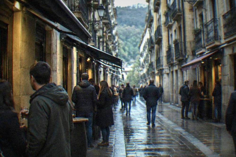
The Old Town also works as the city's compass. Every street in it either climbs toward Urgull or falls toward the harbour, so the slope of the pavement tells you which way the sea is. The basilica of Santa María del Coro closes the district at the foot of the hill, and the San Vicente church stands at the inland edge, two landmarks that frame the rectangle on the map even for a first-time visitor.
The question of what the Old Town is actually called comes up often enough that it has its own page: what the Old Town of San Sebastian is called. The short version is that Parte Vieja is the everyday Spanish name, and you will see it on every street sign in the district.
A guided walk is one way to fix the map in your head on a first evening, and the harbour beside the district is the other half of that plan: the bay sailing with the island stop leaves from there.
Where Do Monte Urgull And Monte Igueldo Sit On The Map?
Monte Urgull rises at the eastern end of the bay directly behind the Old Town, with the Castillo de la Mota on top, and Monte Igueldo rises at the western end above Ondarreta, reached by a rack funicular that opened on 25 August 1912. The two hills bracket the whole city, and both are on the map's edges rather than in its middle.
Urgull is the closer hill to the centre: its slopes start at the harbour, and the tourism board gives its access hours as 08:00 to 21:00 from 1 May to 30 September and 08:00 to 19:30 from 1 October to 30 April, because the hill is closed at night. The Mota castle on the summit holds a small history museum run by San Telmo. Igueldo is the bigger climb, and the funicular, which the tourism board calls the oldest in the Basque Country, runs every 15 minutes on its normal schedule. The funicular's own site prices a return at 5.50 EUR for an adult and 2.50 for a child up to 7, and the ticket includes entry to the grounds, while arriving on foot or by vehicle costs 3.00 EUR per person. One detail the site states plainly: tickets for the downhill-only funicular journey are not on sale, so the round trip is the trip.
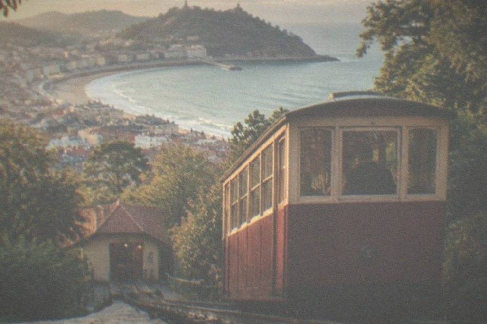
Between them, the two hills give the map its shape and its two best viewpoints. Urgull looks down the length of the bay toward Igueldo, with the Old Town at your feet and Zurriola hidden on the far side. Igueldo looks back the other way, over the whole crescent with the island in the middle, which is the view that appears on most postcards of the city. The funicular's own FAQ adds that rides close on rainy days, so the western viewpoint is the one that needs a weather check.
| Hill | Map position | How to get up | At the top |
|---|---|---|---|
| Monte Urgull | East end, behind the Old Town | Paths from the harbour | Castillo de la Mota, city views |
| Monte Igueldo | West end, above Ondarreta | Rack funicular from 1912 | Viewpoint tower, old amusement park |
Where Is Santa Clara Island On The Map?
Santa Clara Island sits in the middle of La Concha bay, roughly level with the centre of the beach arc, and it is close enough that its small lighthouse and its little beach are visible from the promenade. A regular boat connects it from the harbour during the high season, 1 June to 30 September, plus Easter and long weekends.
The island is not decoration. It has a fourth small beach listed on the council's beaches page, and Hondalea, Cristina Iglesias's work inside the lighthouse, inaugurated in 2021, is open only from 1 June to 30 September, 11:00 to 18:30, in free half-hourly sessions of about 20 minutes, with no booking needed for the visit itself, only the boat. The operator Motoras de la Isla runs a red line direct to the island at 5 EUR return, 10:00 to 19:00 every 30 minutes weather permitting, and a blue line combining a 30-minute bay tour with the island at 8 EUR; children under 4 travel free. Outside the high season the operator says to consult departures, so no winter sailing should be assumed.
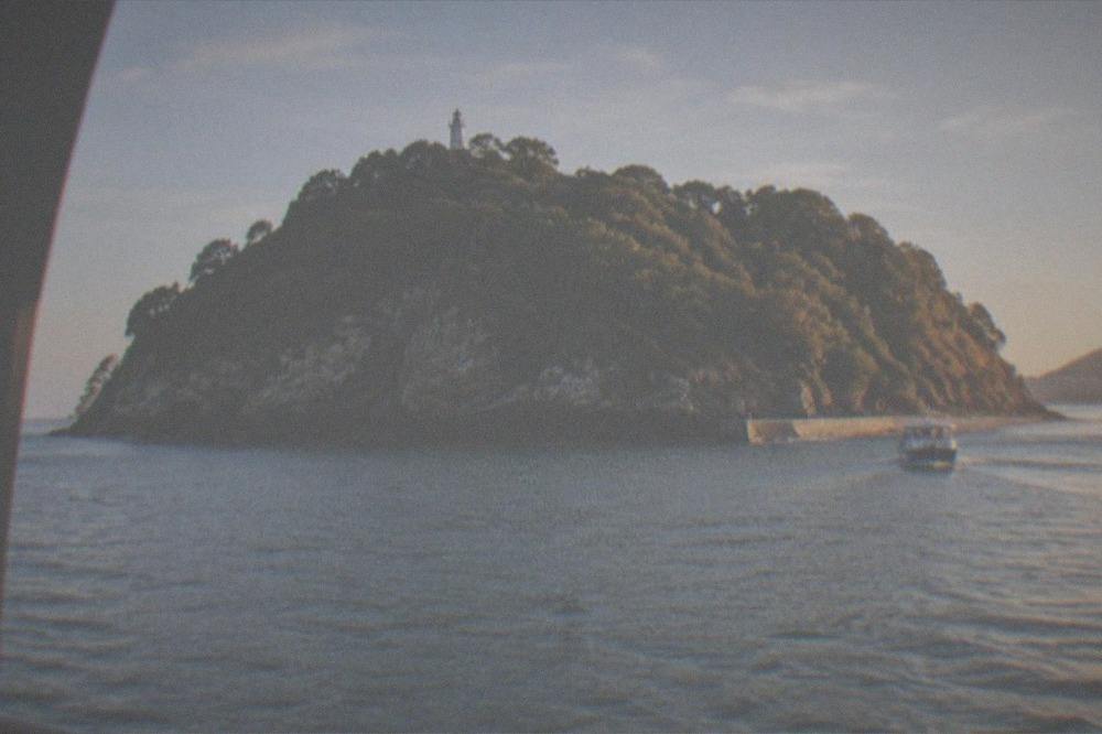
On the map the island does one more quiet job: it breaks the swell that would otherwise run straight into the bay, which is part of why La Concha swims flat while Zurriola, outside the shelter, does not. The boat ride out makes that geography visible in a way the promenade never quite does, looking back at the full crescent from the water.
If the boat idea appeals, you can also Check availability for the bay sailing with the island stop, which the operator's live listing covers in full.
How Do The Outer Neighbourhoods Join The Map Together?
Behind the waterfront the city continues south in a shallow bowl: Amara holds the main rail and bus terminus, Egia lies east of the river around Tabakalera and the Cristina Enea park, and Antiguo spreads west behind Ondarreta toward the university. All of them sit within the MUGI fare system, where an occasional urban ticket costs 1.95 EUR and a MUGI card trip costs 0.78 EUR.
The MUGI tariff gives those figures for urban travel, defined as Donostia and the Pasaia motorboat, so a single ticket covers a wide stretch of the map. The dBus city network is the practical way to cross the bowl when the legs give out, and a night ticket costs 2.65 EUR. The new underground Topo section under the city centre is worth knowing about but not worth planning around: the Basque Government announced in June 2026 that the civil works are finished, but no opening date has been published, and Amara remains the working terminus. The map, in other words, still works the old way.
| Neighbourhood | Direction from the bay | Map anchor |
|---|---|---|
| Antiguo | West, behind Ondarreta | Miramar Palace, university area |
| Amara | South, inland | Main rail and bus station |
| Egia | South-east, across the river | Tabakalera, Cristina Enea park |
| Gros | East, behind Zurriola | Kursaal, surf beach |
Which Day Trips Leave From The Edges Of The Map?
The day-trip map radiates in five directions from the bus station: west along the Gipuzkoa coast to Zarautz, Getaria and Zumaia, south-west into Rioja, east across the French border to Biarritz, Bayonne and Saint-Jean-de-Luz, south-east to Pamplona, and immediately south to the cider houses of Astigarraga and the Chillida Leku museum in Hernani.
Each of those edges has its own character. The coast road west passes the txakoli country around Getaria, the fishing town that also holds the Cristóbal Balenciaga museum, and continues to the flysch cliffs of Zumaia inside the Basque Coast UNESCO Global Geopark. The French border is close enough that Biarritz is a normal half-day, and the Rioja wine country is a full day. The cider houses of Astigarraga are the nearest edge of all, and the txotx season, when cider is poured straight from the barrel, runs from the middle of January to the end of April in the tourism board's wording. The day trips guide covers how to sequence them against city time, and what San Sebastian is known for explains why visitors tend to spend the first two days barely leaving the bay.
| Direction | Destinations | Character |
|---|---|---|
| West along the coast | Zarautz, Getaria, Zumaia | Txakoli, fishing ports, flysch cliffs |
| Across the border | Biarritz, Bayonne, Saint-Jean-de-Luz | French Basque towns and beaches |
| South-west | Rioja, Laguardia | Walled town, wineries |
| South-east | Pamplona | The bull run route |
| Just south | Astigarraga, Hernani | Cider houses, Chillida Leku |
One of these edges can also be walked rather than driven. The coastal Camino de Santiago crosses the city as stage two of the Gipuzkoa route, arriving from Pasaia and leaving toward Orio, so a pilgrim on the map walks the whole bay from east to west before heading out along the coast.
For anyone whose ideal map of the city includes a walking trail with a glass at the end of it, the coastal winery walk is the one that combines both, following the shoreline east with tastings built in.
How Does The Weather Shape The Map You Will Actually Use?
AEMET's normals for its Igeldo station, on the hill at 250 metres above the bay, record 1,507 mm of rain a year over 141 days, with July the driest month at 86 mm and November the wettest at 169 mm, so the map you use should always include an indoor option within walking distance. The seafront runs slightly warmer than these station values, but no month is dry.
This is a wet Atlantic city, and the honest planning consequence is that the beach map and the rainy-day map overlap. The Old Town's bars, San Telmo Museoa with its free Tuesdays, and Tabakalera's free-access building all sit within the same walkable strip as the beaches, which is why the city absorbs rain better than most. San Telmo charges 10.00 EUR general admission and 4.00 reduced, opens Tuesday to Sunday, and closes Mondays; the museum's own page lists the free Tuesday for everyone. August, the busiest month in the INE hotel figures with 245,769 overnight stays in 2025, is also wetter than June, July or September in the rain table, so the two maps, sunny and rainy, are the same map.
Common Questions About The San Sebastian Map
Is San Sebastian Walkable Without A Car?
Yes. The bay, the Old Town, the Centre and Zurriola are all inside one walkable strip between the two hills, and dBus covers the rest, with an occasional urban ticket at 1.95 EUR per the MUGI tariff.
Which Side Of The Map Should You Stay On?
The Old Town and the Centre put the pintxo bars and La Concha within minutes of each other; Gros puts you beside the surf beach; Antiguo is quieter and near Ondarreta. The choice is covered in the beachfront and Old Town hotels guide.
Can You See The Whole Bay From One Point?
From the top of either hill you can, and the bay boat gives the same view from the water, which is why the island stop is worth the sailing.
Where Does The Camino De Santiago Cross The Map?
The coastal Camino enters the city from Pasaia in the east and leaves toward Orio in the west, so pilgrims cross the entire map on foot through the Centre and along the bay.
Is The Island In The Bay Part Of The City?
Yes, Santa Clara island is municipal, it has a small beach listed on the council's beaches page, and Hondalea in its lighthouse is free to visit during the summer season with no booking for the visit itself.
The map of San Sebastián is small, but every edge of it pays off: two hills, three beaches, an island, a medieval core and a river, all inside a walk. More on the city and its name is in the Donostia or San Sebastian explainer, and the full run of San Sebastian Spain Guide pages covers each corner of the map in turn.