Zumaia And The Flysch Route
The cliffs at Zumaia, west of San Sebastián along the Gipuzkoa coast, are one of the most continuous rock records on Earth. This guide covers the flysch route, the coastal walk, and how to build the day trip.
Short answer
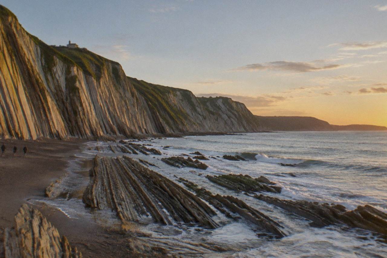
Zumaia is a fishing town on the Gipuzkoa coast, about an hour west of San Sebastián by road, where the Basque Coast UNESCO Global Geopark exposes tens of millions of years of layered rock, the flysch, along the shoreline between Zumaia and Deba.
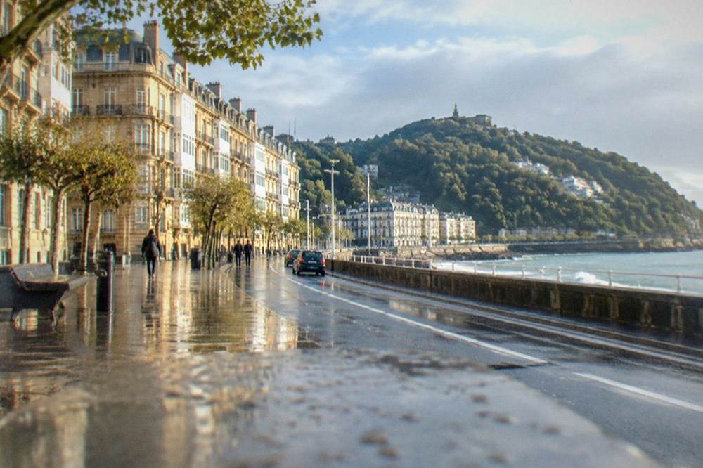
The coast west of San Sebastián, the Basque city on La Concha bay whose official name is Donostia / San Sebastián, changes character at the town of Zumaia. The sandy arc of La Concha gives way to vertical cliffs of repeating grey and rust layers, rock folded and tilted until it reads like the pages of a book stood on end. Geologists call this a flysch, and the Zumaia flysch is the exposure that gives the Basque Coast UNESCO Global Geopark its scientific weight: a sequence laid down over tens of millions of years, now walkable at low tide along the shoreline. For a visitor based in San Sebastián it is the most dramatic half of a classic coast day, usually combined with Getaria and Zarautz on the way out, and this page lays out what the flysch is, what you actually see, and how to plan the trip.
What Is The Zumaia Flysch?
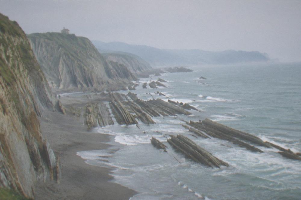
The Zumaia flysch is a cliff-face sequence of alternating hard and soft rock layers, sandstone and mudstone, laid down on the sea floor over roughly fifty million years and later tilted upright by the collision of the Iberian and European plates, so that walking along the beach at Zumaia means walking forward through time, layer by layer. The layers record deep-sea conditions, submarine avalanches and the slow approach of the Pyrenees, and one of the boundaries in the sequence corresponds to the extinction event that ended the age of dinosaurs. The Geopark that protects it covers three municipalities, Zumaia, Deba and Mutriku, and has been a member of the European and Global Geoparks Networks since 2010 and a UNESCO Global Geopark since 2015. It is a day trip from San Sebastián, not a city sight, and it is the single best reason to spend a day on this stretch of coast.
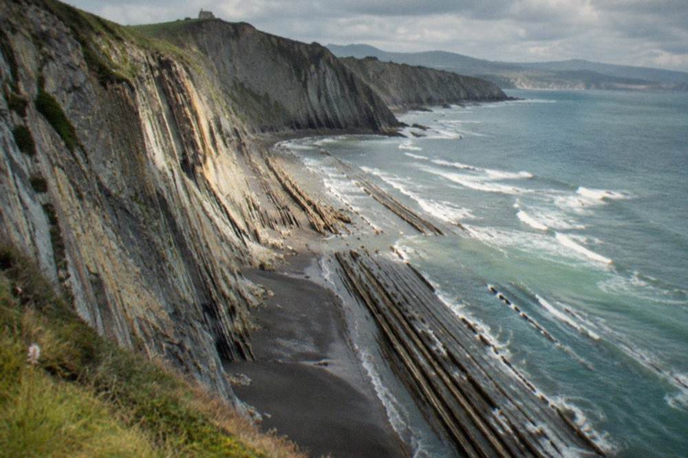
The word flysch comes from Swiss geology, where the same rhythm of hard and soft layers was first described in the Alps. At Zumaia the sequence is unusually continuous and unusually accessible. The hard layers stand out as ribs on the beach; the soft layers between them erode into the grooves. Because the whole stack was tipped on its side, a horizontal stroll of a few hundred metres can cross vertical distances in the rock record that would need a mountain range to expose elsewhere.
The town itself is small and built around a harbour, with the parish church of San Pedro above it. The cliffs begin at the western end of Itzurun beach, the town beach, and continue west and east along the coast. Visitors come for the rock, take the walk, eat in the harbour, and leave; there is no large museum or monument in the town itself, and none is needed. What there is instead is a landscape that changes with every tide, every swell and every hour of light, which is why photographers return to the same few hundred metres of shoreline again and again.
How Do You Get From San Sebastian To Zumaia?
There is no train to Zumaia, so the trip from San Sebastián runs by road: by rental car along the coast road that strings Zarautz, Getaria and Zumaia together, by Lurraldebus interurban bus, or on a small-group day tour that bundles Zumaia with Getaria and Zarautz in one vehicle with a guide. The tourism board's Camino listing confirms the geography of the coast, Zarautz, then Getaria, then Zumaia, then Deba, which is the order most day trips follow westward. The pack gives no driving time, bus frequency or fare for this route, so check the operator's own timetable before setting out; what it does give is the shape of the day, three towns on one coast road, each with a different character.
Going independently, the practical plan is to drive or bus to Zumaia first, walk the flysch while the light and the tide suit, then work back east through Getaria, the fishing town where txakoli vines grow above the harbour and the Cristóbal Balenciaga Museoa stands, and Zarautz, with the longest beach on this coast. Doing it in the other direction means arriving at Zumaia in the late afternoon, when the walk is rushed and the best light has gone.
Going with a tour, everything is handled: the vehicle, the timing and the explanation of what the rock layers mean. A guide who can point to a single dark band in the cliff and name the boundary it represents changes the walk from scenery into a story, and that is the part most self-guided visitors miss. The listing below covers the classic three-town coast day from San Sebastián, and there are other ways to spend a day out of the city collected on the day trips from San Sebastián page.
What Can You See In Zumaia On A Day Trip?
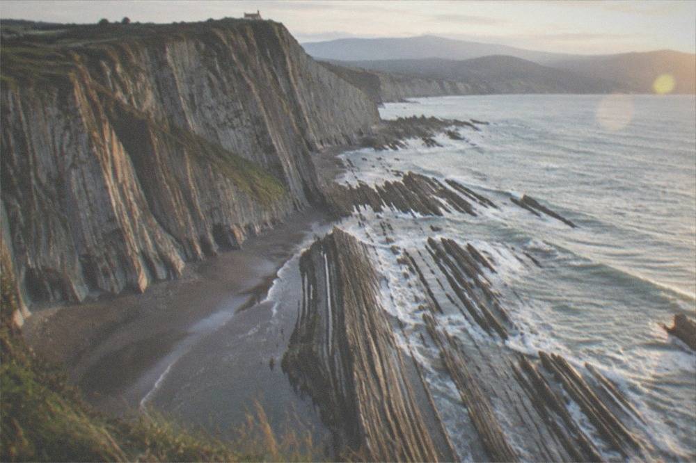
The four things to see in Zumaia are the flysch cliffs at the west end of Itzurun beach, the tilted rock platform on the beach itself at low tide, the harbour and town front above it, and the coastal path that runs east and west along the Geopark shoreline toward Algorri and Deba. The cliffs are the destination; everything else is framing. Itzurun beach is the town's sandy beach, and the layers rise directly from its western end, so the geology is visible from the sand without any walk at all. The serious views come from the coastal path above, where the full height of the sequence is exposed.
Here is how the pieces of a Zumaia day fit together:
| Stop | What it is | What you do there |
|---|---|---|
| Itzurun beach | The town beach, with the flysch at its west end | Walk the sand, view the layers at close range |
| The flysch cliffs | Tilted rock sequence, tens of millions of years deep | Photograph from beach and clifftop path |
| Coastal path | Geopark trail heading west along the shore | Walk a section, out and back |
| Zumaia harbour | Working fishing port and town front | Lunch, coffee, watch the boats |
| San Pedro church | Parish church above the town | Short look on the way up from the harbour |
The tide matters more than the clock. At low tide the wave-cut platform is exposed and the layers can be read from the beach; at high tide the sea covers the platform and the cliffs are seen only from above. Tide tables for the Basque coast are published by the harbours authority, and the walk west of Itzurun should only be made along the shore itself with local knowledge of the tide; the clifftop path is the safe alternative and needs no timing.
Is The Zumaia Walk Suitable For Casual Hikers?
The clifftop walk above the flysch is suitable for anyone used to a coastal path: it is a well-used trail on grass and earth above the cliffs, with short steep sections between the beach level and the headland, and no scrambling. The shoreline route beneath it, along the base of the cliffs toward Algorri, is a different proposition: it is tide-dependent, crosses loose rock, and should not be attempted when the sea is high or the swell is up. The council's beach pages for San Sebastián describe the Atlantic here as an open coast with strong swell on its surf beach, and the same sea runs along this whole shoreline.
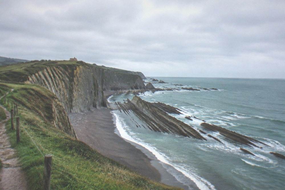
The Camino de Santiago uses this coast, which is the best evidence that the walking is reasonable: the tourism board's coastal route runs stage five through Zarautz, Getaria and Zumaia and stage six on from Zumaia through Itziar to Deba, so pilgrims with full packs walk this ground daily through the season. The board publishes no stage distances, so plan by time and daylight rather than by kilometres.
For a day-tripper the sensible version is an out-and-back from Itzurun beach along the clifftop, turning around whenever the group's legs or the weather say so. Rain is the real constraint, not gradient. AEMET's normals for the Igeldo station above San Sebastián show rain on about ten days even in the driest month, July, and the clifftop path turns slippery in wet weather. The San Sebastián weather alternatives are worth having in mind before you commit to the date.
Footwear is the other practical detail. Trainers with grip are fine on the clifftop path in dry conditions; the shoreline route asks for more, because the wave-cut platform is wet, uneven and crossed by seaweed. Children can manage the beach and the first stretch of cliff, but the full coastal walk is a commitment that suits adults and older teenagers better than a family with a pram.
When Is The Best Time To Visit The Zumaia Flysch?
The best months for the Zumaia coast are May, June and September: AEMET's normals for the Igeldo station show those months combining mean temperatures between 14.4 and 18.9 C with 90 to 120 mm of rain, against November's 169 mm and 13 rain days, and September adds the two La Concha regatta Sundays back in the city as a reason to be in the region. July is the driest single month at 86 mm, but it is also the busiest on the coast. October is still warm at a 15.5 C mean but wetter, at 159 mm, than any month except November.
The same station data, month by month, for planning a coast day:
| Month | Mean temp C | Rain mm | Rain days (1 mm+) | Sun hours | Verdict for the coast walk |
|---|---|---|---|---|---|
| Jan | 8.5 | 141 | 13.2 | 98 | Cold, wet, short days |
| Feb | 8.7 | 110 | 11.6 | 107 | Quiet, still wintry |
| Mar | 10.3 | 113 | 12.4 | 144 | Changeable |
| Apr | 11.3 | 138 | 13.4 | 157 | Green, showery |
| May | 14.4 | 120 | 12.2 | 181 | Good balance |
| Jun | 16.9 | 90 | 10.6 | 189 | Very good |
| Jul | 18.9 | 86 | 9.8 | 196 | Driest, busiest |
| Aug | 19.5 | 117 | 10.5 | 190 | Warm, peak crowds |
| Sep | 18.0 | 111 | 10.1 | 179 | Very good |
| Oct | 15.5 | 159 | 11.8 | 140 | Mild, wetter |
| Nov | 11.3 | 169 | 13.0 | 102 | Wettest month |
| Dec | 9.1 | 151 | 12.4 | 93 | Short, stormy |
Two seasonal notes carry over from the city's own calendar. The lifeguard and beach-hire season on San Sebastián's beaches runs 1 June to 30 September, which is a fair proxy for when this coast is treated as beach-and-cliff season rather than walking season. And the txotx cider season, the middle of January to the end of April by the tourism board's rule, means a winter or spring trip can be folded into a cider house lunch in Astigarraga on the way back, if the day is shaped for it.
What Else Can You Combine With Zumaia?
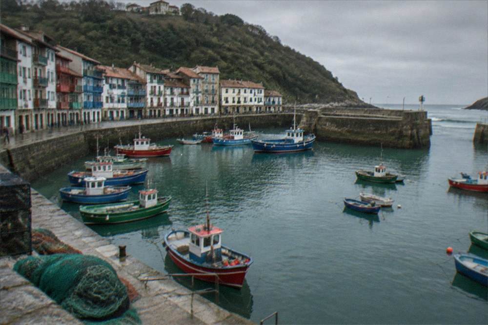
The classic combination is Getaria and Zarautz: Getaria for its fishing harbour, the txakoli vines on the slopes above it and the Cristóbal Balenciaga Museoa, and Zarautz for the longest beach on this stretch of coast, all three towns strung along the same coast road west of San Sebastián. Getaria is a separate municipality, not a suburb of the city, and so is Zarautz; each has its own character and its own reason to stop. The Balenciaga museum's own site gives its admission as 14 EUR general and 9 EUR reduced, open Tuesday to Sunday 10:30 to 18:00 from April to October, Wednesday to Sunday 10:30 to 17:00 from November to March, and daily 10:30 to 20:00 in July and August, with last entry 30 minutes before closing.
How the three stops divide up a coast day:
| Town | What it is known for | Best stop for |
|---|---|---|
| Zarautz | The long beach and the seafront | A walk on the sand before lunch |
| Getaria | Fishing harbour, txakoli, Balenciaga Museoa | Museum visit, harbour lunch, a glass of txakoli |
| Zumaia | The flysch cliffs and the Geopark coast | The cliff walk and the geology |
The Camino connection links all three: pilgrims on the coastal route walk Zarautz to Getaria to Zumaia as one stage and continue to Deba the next. If your day runs east to west, you are following the pilgrim arrow of the route, and the yellow markings on the path are the same ones that guide walkers all the way to Santiago. More on that route is on the Camino del Norte page.
Should You Take A Tour Or Go Independently To Zumaia?
Go independently if you want to control the tide timing and linger on the cliffs; take a small-group tour if you would rather not drive the coast road, want the rock layers explained, or want Zumaia bundled with Getaria and Zarautz without planning three bus timetables. The independent route costs a rental-car day or bus fares and gives you the low-tide window, which matters more than any other single planning decision. The tour route trades that control for a guide who can read the flysch, a driver who knows the coast road, and a single booking that covers the whole day.
For walkers who want the coast under their boots rather than through a window, there is a guided option that follows the shoreline with tastings built in:
And for visitors whose real interest is the sea rather than the rock, the same stretch of Atlantic that carves the flysch also breaks onto the beaches closer to the city, and a surf morning paired with a pintxo evening is a different way to meet the same ocean:
The choice mostly comes down to transport and tide. If you have a car and a tide table, drive. If you have neither, or if you are travelling in the shoulder season when you would rather have someone else watching the forecast, book. The San Sebastian Spain Guide day trip pages cover the other directions too, including Hondarribia east and Bilbao inland, if the coast forecast is poor and the trip needs a rethink.
Common Questions About Zumaia And The Flysch
What is the Zumaia flysch?
The Zumaia flysch is a cliff sequence of alternating hard sandstone and soft mudstone layers, laid down on the sea floor over tens of millions of years and later tilted upright by plate collision, so the layers read like pages of a book along the shore at Zumaia, west of San Sebastián.
How far is Zumaia from San Sebastian?
Zumaia sits on the Gipuzkoa coast west of the city, reached by road through Zarautz and Getaria. The pack publishes no driving time for the route, so check the operator or your map before planning; the tourism board's Camino stages confirm the order of the towns along the coast.
Can you walk along the flysch at Zumaia?
Yes, with care. The clifftop path above the cliffs is a well-used trail suitable for most walkers, while the shoreline route beneath the cliffs is tide-dependent and crosses loose rock, so it should only be walked with knowledge of the tide and never in high swell.
Is Zumaia part of a UNESCO site?
Zumaia is one of the three municipalities of the Basque Coast UNESCO Global Geopark, with Deba and Mutriku, a UNESCO Global Geopark since 2015. It is not a World Heritage Site, and neither is San Sebastián itself; the city's only World Heritage link is the Camino coastal route that crosses it.
What is the best time of year to visit the Zumaia flysch?
May, June and September balance temperature and rain best on AEMET's Igeldo normals, with July the driest single month at 86 mm but the busiest. November is the wettest at 169 mm and is the least reliable month for a cliff walk.
Can you combine Zumaia with Getaria and Zarautz in one day?
Yes, and it works well: the three towns sit along the same coast road, Getaria for the harbour, txakoli and the Balenciaga museum, Zarautz for the long beach, and Zumaia for the flysch, and small-group tours from San Sebastián cover all three in one vehicle.
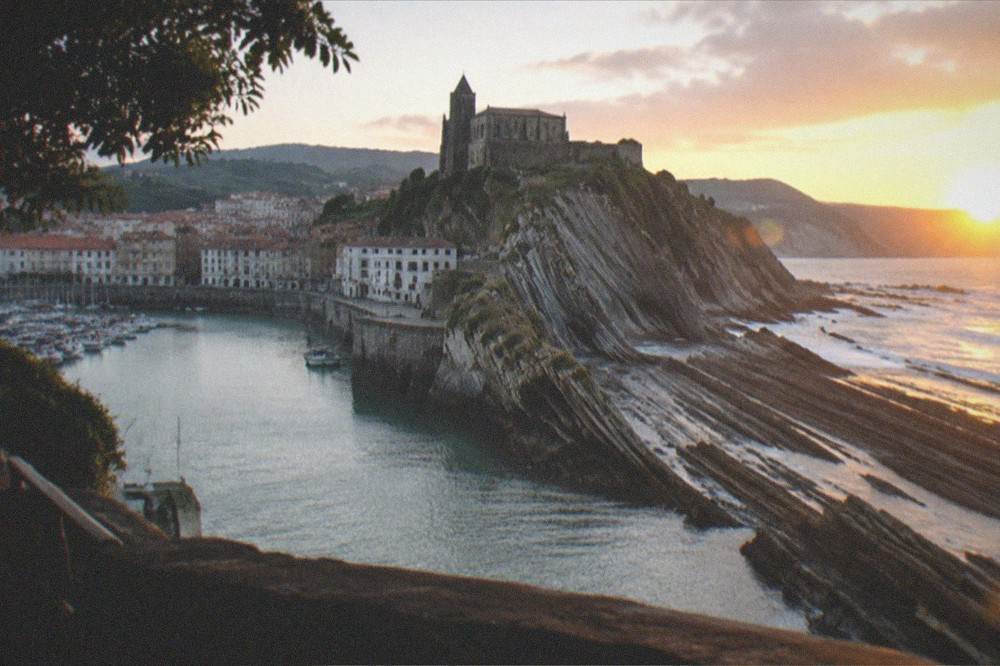
One last planning point: the flysch is at its best in the hours around low tide and in the low light of morning or late afternoon, when the relief between the hard and soft layers shows most sharply. Build the day around the tide table rather than the clock, keep a rain plan in reach, and the coast west of San Sebastián delivers the most photogenic geology in the Basque Country.